Full Forecast from Weatherology
Winter Storm Warning
…Significant Winter Storm Today into Wednesday Morning…
…WINTER STORM WARNING REMAINS IN EFFECT UNTIL 6 AM CST WEDNESDAY…
Issued: 1009 AM CST Tue Dec 29 2020
PRECAUTIONARY/PREPAREDNESS ACTIONS
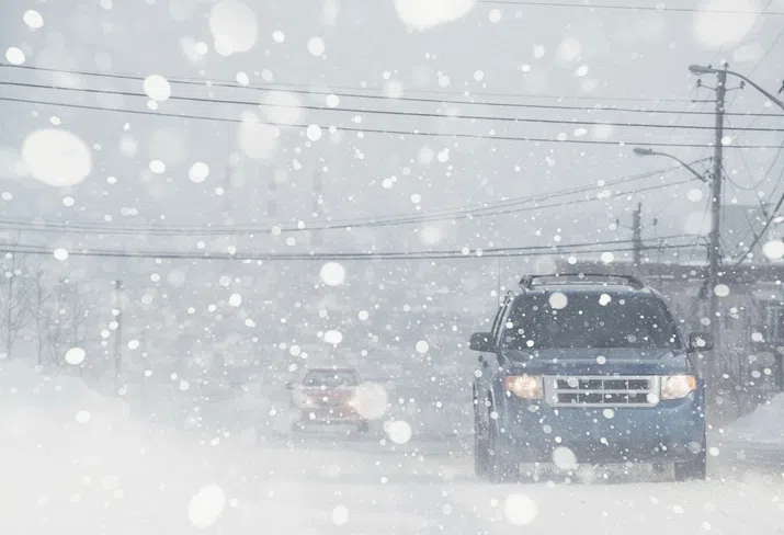
If you must travel, keep an extra flashlight, food, and water in your vehicle in case of an emergency. The latest road conditions for the state you are calling from can be obtained by calling 5 1 1.
If you must travel, keep an extra flashlight, food, and water in your vehicle in case of an emergency. The latest road conditions for the state you are calling from can be obtained by calling 5 1 1.
WHAT
Heavy snow expected mixed at times with sleet. Total snow accumulations of 5 to 8 inches with locally higher amounts possible. The highest end of that range will be in central Iowa toward eastern Iowa. Wintry mix and ice accumulations of up to two tenths of an inch in the south today and up to one tenth of following the snow elsewhere in the warning area.
Heavy snow expected mixed at times with sleet. Total snow accumulations of 5 to 8 inches with locally higher amounts possible. The highest end of that range will be in central Iowa toward eastern Iowa. Wintry mix and ice accumulations of up to two tenths of an inch in the south today and up to one tenth of following the snow elsewhere in the warning area.
WHERE
Parts of northern and central Iowa.
Parts of northern and central Iowa.
WHEN
From 9 AM Tuesday to 6 AM CST Wednesday.
From 9 AM Tuesday to 6 AM CST Wednesday.
IMPACTS
Travel could be very difficult. The hazardous conditions will especially impact the afternoon and Wednesday morning commutes. The weight of the snow and ice may also result in sagging tree limbs and damage, with power outages possible.
Travel could be very difficult. The hazardous conditions will especially impact the afternoon and Wednesday morning commutes. The weight of the snow and ice may also result in sagging tree limbs and damage, with power outages possible.